It’s been a busy few months. Among other things, I presented at the Advances in Visual Methods for Linguistics 2016 conference held here in Brisbane last week; I submitted a paper to the Social Informatics (SocInfo) 2016 conference being held in Seattle in November; and I delivered a guest lecture to a sociology class at UQ. Somewhere along the way, I also passed my mid-candidature review milestone.
Partly because of these events, and partly in spite of them, I’ve also made good progress in the analysis of my data. In fact, I’m more or less ready to draw a line under this phase of experimental exploration and move onto the next phase of fashioning some or all of the results into a thesis.
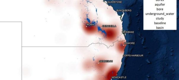
With that in mind, I hope to do two things with this post. Firstly, I want to share some of my outputs from the last few months; and secondly, I want to take stock of these and other outputs in preparation for the phase that lies ahead. I won’t try to cram everything into this post. Rather, I’ll focus on just a few recent developments here and aim to talk about the rest in a follow-up post. Specifically, this post covers three things: the augmentation of my dataset, the introduction of heatmaps to my geovisualisations, and the association of locations with thematic content. Continue reading Where are we now?→
In Queensland, as in much of Australia, water is a scarce resource. Except in the monsoonal north, the annual rainfall tends to range from low to unreliable. Good years follow bad years; droughts follow floods. The continued availability of water for human use and environmental health cannot be taken for granted: it must be planned for. In Australia, the responsibility for this planning rests with the state and territory governments.
When I joined Queensland’s Department of Natural Resources 1 in 2006, the state’s surface water resources (rivers and overland flows) were pretty well accounted for. Water resource plans — the state’s legislative instrument for allocating water among competing uses — had been prepared for nearly every river basin in the state. The department was now grappling with the more difficult task of accounting for the state’s groundwater.
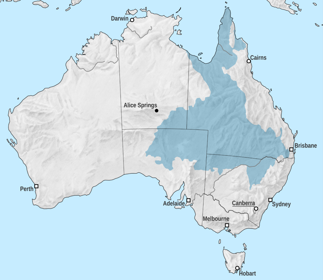
In many parts of Queensland, underground reservoirs (or aquifers) are the only reliable source of water. Across much of the state’s arid interior, human settlement and agricultural activities would be virtually impossible without water from the Great Artesian Basin — an enormous sequence of aquifers that underlies much of the eastern half of the country. Closer to the surface, there are numerous alluvial aquifer systems — the most significant being the alluvium of the Condamine River in the Darling Downs — which support regional towns and intensive irrigation districts.
The extent of the Great Artesian Basin (Image source: Wikipedia, contributed by Tentotwo.
Over the past century, many groundwater systems in Queensland have effectively been ‘mined’ as water has been taken at a rate faster than it is naturally replenished. Drastic reductions in water use from these systems have been (and are still being) enacted to return water extraction to within sustainable limits.
However, determining what these limits are is no trivial task. The workings of groundwater systems are largely hidden from view, and the only way to develop a picture of them is to drill holes in the ground and piece together the observations taken at each one. I remember a groundwater engineer in the department likening this process to punching holes into a book and reconstructing the plot by studying the confetti. That analogy might be a slight exaggeration, but it does illustrate why every hole drilled, and every bit of data collected, is so precious. We can really only guess at how a groundwater system works, and sometimes the data from a single hole will make all the difference between a good guess and a bad one. Continue reading Queensland’s Groundwater Database – The Movie!→
Notes:
The department wasn’t actually called this in all the time it was there, but for the sake of simplicity, that is what I am calling it here! ↩