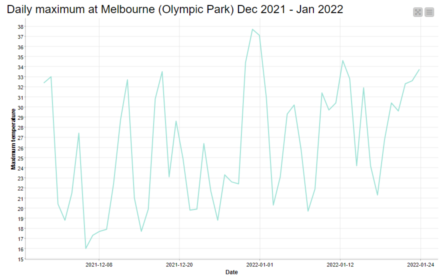
Depending on which weather station you follow, Melbourne is currently on track to experience eight consecutive days with maximum temperatures of at least 30 degrees Celsius. At the Olympic Park station, every day since Thursday 20 January has been over 30°C except for Friday the 21st, which was 29.6°C. At Essendon Airport, where temperatures have been about a degree hotter, Friday saw a maximum of 31.9°C. The temperature in Melbourne as I write this is already over 33°C, and the forecast for tomorrow is 34°C. If Friday’s forecast of 30°C comes to pass, then that would bring the stretch to nine days.

I came to Melbourne from Brisbane exactly three years ago, and I don’t recall experiencing a period of continuous heat like this since then. There have been some savagely hot days to be sure, but most of them have concluded with a dramatic cool change, and been followed by a comfortable day in the mid 20s — hence the prevailing yo-yo pattern in the graph above. Every one of these cool changes has made me feel better about my decision to desert Brisbane’s subtropical climate for Melbourne’s erratic weather. A week of 30+ temperatures is what I would expect to endure in Brisbane, and is exactly what I came to Melbourne to avoid.
How historically rare is this current succession of hot days in Melbourne? To find out, I dusted off an analytical tool that I created a couple of years ago to better understand the climatic trends in Brisbane and Melbourne. Called the HeatTraKR, the tool is a workflow for the KNIME Analytics Platform that crunches data from the Bureau of Meteorology to produce a variety of outputs. One of the questions that I created the tool to answer was whether long stretches of hot days were becoming more frequent in Brisbane (the answer was a tentative maybe). So the tool is perfectly equipped to answer my present question about Melbourne’s heatwave. Continue reading A week over 30: How rare is Melbourne’s current heatwave?
